Published
09.12.2023
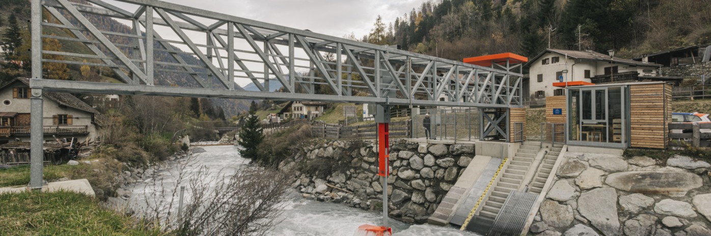
This is a question that is not only being asked on Italy’s beaches, which are formed by these very sediments, but also here at NOI Techpark. Two companies based here, CISMA and Mountain-eering, are studying these hydrogeological anomalies. In collaboration with the Italian Civil Protection Agency and the Free University of Bozen-Bolzano (unibz), they have developed a new system that measures the movement of water and rock in Alpine streams. For the first time, this system provides precise information rather than estimates. Currently being tested in the Solda river, the system uses data-supported monitoring of sediment movement to make it possible to plan infrastructure for protecting against hydraulic risks. This is the first prototype of its kind in Italy. An innovative CISMA-programmed algorithm significantly reduces the size of the collected data, enabling data acquisition without loss of information.
Data is collected using a system developed by Mountain-eering. A metal plate is set into a concrete structure at the point where the riverbed slopes. A geophone (a type of seismograph) is installed under this plate to record vibrations caused by pebbles falling onto the riverbed. The rocks then fall into a metal mesh which collects and weighs the sediment. This makes it possible to combine information on both time and quantity. Unibz processes data from this and other measuring stations on behalf of the provincial authority, with the aim of improving understanding of the transport of Alpine riverbed sediment and developing strategies for managing hydraulic and ecological risks.
Find out more about this service here.