Published
24.04.2026
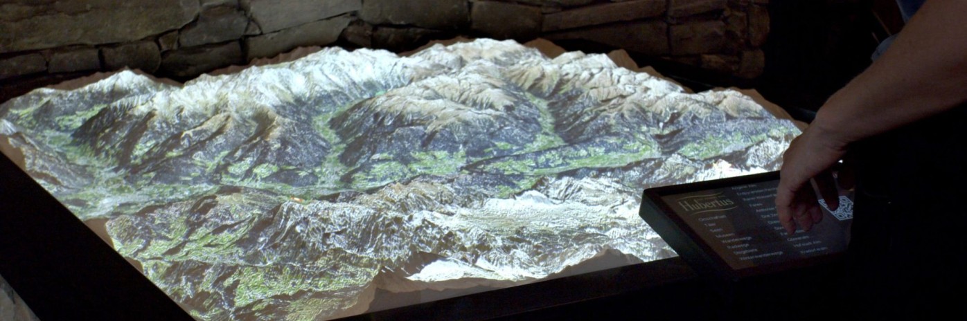
How can we better understand geographical environments? The ËRT project offers an innovative answer: it creates interactive landscape models in the form of 3D wooden reliefs enhanced by digital projections. Information such as the position of the sun, snow cover, and other geographical data appears directly on their surfaces. An approach that makes it possible to experience landscapes from a perspective reminiscent of satellite imagery, clearly revealing spatial relationships. The system is powered by reliable weather and geodata from the Open Data Hub, which is seamlessly integrated and projected onto the 3D models in real time. The result is a set of applications that communicate complex geographical information in an intuitive and engaging way.
Find out more in the video: